Overview
The U.S. Army Engineer Research and Development Center (ERDC) seeks advanced capabilities for sensing and predicting operationally relevant variables in polar and subpolar snowpack and terrain surface stability. Elements of focus are listed below in the problem statement. A total of up to approximately $4,000,000 may be available to make one or several awards for solutions that deliver new instrumentation, methodologies, tools, software repositories, etc. for advanced snow and terrain characterization meeting these focus areas.
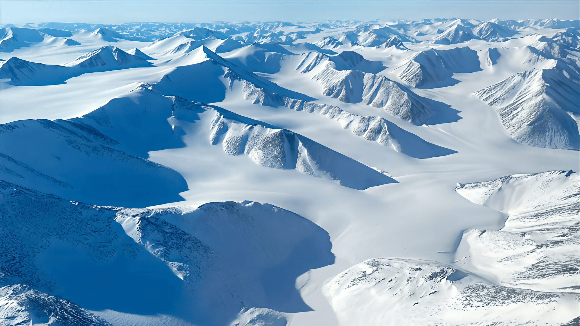
Instruments and methods that characterize Arctic terrain properties are critical for U.S. Army planning and terrain operations in polar and subpolar terrain characteristics. While a great deal of effort has been expended studying the environment and conditions of the polar and subpolar regions, most of the region remains significantly under-observed, and most available observations are often not directly applicable to terrain engineering needs. Many variables of particular tactical importance have received relatively little attention in geophysical research of recent years. To close these gaps in sensing the polar and subpolar environment for domain exploitation, the Department of Defense requires new techniques for assessing the following topics.
Project Objective
This Individual Program Requirement (IPR) seeks to develop new solutions, or advance existing partial solutions, to address sensing and prediction needs. Two topic areas are presented, each with a list of target variables and threshold vs objective levels for meeting those variable quantification needs. Acceptable proposals may address one or both topic areas, and some or all of the target variables under a topic, and may plan to address some topics at threshold level and others at objective level. A responsive proposal must address at least one variable to at least threshold level. All proposals should clearly state which topics, variables, and objective levels they seek to meet.
Demonstration of sensing and/or prediction capacity for high accuracy quantification of snow state including novel sensing techniques, novel analysis techniques, and/or novel data synthesis techniques leading to quantification of one or more of the following variables:
- Snow depth and SWE, particularly capturing horizontal spatial heterogeneity of accumulated snow on the ground in all seasons at the sub 100m resolution horizontal scale and with targeted vertical accuracy of 10cm or better depth or 3 cm or better water equivalent, in all seasons, in polar and subpolar landscapes.
- Snow surface topography and roughness, as relevant to over-snow mobility, at sub 100m resolution horizontal scale in polar and subpolar landscapes.
- Snow surface grain size and bonding state, as relevant to aeolian snow grain entrainment and visibility reductions at 100m resolution scale, which includes quantification of both threshold wind velocity (target accuracy of 1 m/s) and available load in polar and subpolar landscapes.
Any technique for a Topic 1 variable should contribute to proof-of-concept, laboratory validation, or field validation that would be expect to result in spatially continuous map-like quantification, possibly through integration of observations and other analysis.
The technique should also:
- Include documentation of the conditions and locations where accuracy is degraded, if any.
- Include a well-documented theoretical basis for the technique and its uncertainty
- Exhibit reasonable potential for future upscaling of the methodology and workflow to 100’s of km domain scales
Demonstration of tools or techniques for sensing and determining the properties of Polar operational surfaces that are ultimately relevant for use by vehicles, structures, and operations. Tools and techniques being developed should contribute to improved estimates of:
- Snow load bearing capacity and shear strength, with a target of ground-validated accuracy in load bearing capacity of 0.1 MPa or better.
- Surface frozen layer thickness and load bearing capacity across frozen wetlands, rivers, lakes, and oceans, particularly physics-based sensing methods to assess the surface frozen layer without personnel risk, identify thickness variation and flaws, and measure surface deflection under load. Techniques should target determining the thickness of the frozen layer with an accuracy of 20% the total thickness or 5 cm.
- Detection, prediction, or mapping of common hazardous polar subsurface voids and inconsistencies, including but not limited to thawed ice wedges in permafrost, shelf ice suspended along rivers, crevasses in glaciers, wetland surface vegetation mats, lead-edge drifts in sea ice, and river overflow beneath snowpacks.
Any technique for a Topic 2 variable should contribute to proof-of-concept, laboratory validation, or field validation of a technique that would:
- Result in proposed use-evaluation scale information (e.g. assessing the safety of a proposed runway, landing zone, or route across a landscape, not necessarily assessing in map-like fashion the safety of an entire region.)
- Have a reasonable potential for future upscaling of the methodology and workflow to permit rapid surface suitability assessment.
The technique should also:
- Include a well-documented theoretical basis for the technique and its uncertainty
- Include quantification of accuracy and uncertainty relevant to risk-based decision making.
While it is expected that at least some new sensing techniques are required, there are no limitations on approaches. We encourage proposers to put forth the best available combination of in situ, modeling, and remote sensing techniques as well as physics-based and data driven techniques. Similarly, while the goal of this program is to validate techniques in a relevant environment (TRL5), not all efforts need to progress from proof of concept (TRL3) to validation (TRL5) within the scope of the work proposed. Where appropriate to de-risk a truly novel technique, proof-of-concept study can be considered, and where concepts are already proven, laboratory and field validation can be conducted. Appropriate publication, documentation, and dissemination of work is required as these are key to realizing the subsequent technology transitions that will bring value to the Army warfighter.
Threshold Goal: As a minimum, any proposals considered must deliver a solution able to meet these required outcomes. Proposals unable to deliver a solution addressing these outcomes will be excluded.
Objective Goal: An ideal solution under this funding profile would deliver this outcome.
- Threshold requirement as stated above, and
- Include an in-situ validation of the approach and quantification of accuracy and uncertainty across a km-scale or larger domain at a Polar Proving Ground site
- (for Topic 1) Include delivery of a complete workflow for acquisition, processing, and efficient delivery of mapped data over 100km+ scale domains, or (for Topic 2) Include delivery of a field validated technique with complete workflow for acquisition, processing, and efficient evaluation of the variable across realistic use-case scenarios, along with quantification of accuracy and uncertainty.
Project Manager
Cold Regions Research and Engineering Laboratory (CRREL), U.S. Army Engineer Research and Development Center (ERDC)
Work Location
Though techniques should be developed with global applicability, we will strongly prioritize work that is conducted at, designed to assess conditions at, or validated at a limited set of several representative sites (“Polar Proving Grounds”) on U.S. soil. These sites have been selected over the course of prior programs. They are easy-to-access, cost-effective study locations that represent prevailing conditions in key canonical polar and subpolar environment types. Each has extensive existing research infrastructure and prior observation libraries that can, and should, be leveraged in developing new techniques. Directing additional relevant work to these locations has substantial benefits to both current and Army future studies and greatly limits duplication of effort required to collect baseline observations. All sites are open to investigators from any U.S. institution. These “Polar Proving Grounds” and the canonical polar or subpolar environment they represent are:
- Juneau Ice Field, AK: Ice Sheet and Maritime Snowpack
- Baxter State Park, ME: Alpine Tundra, Temperate Forest
- Mount Washington Observatory (MWOBS), NH: Alpine Tundra, Alpine Boreal Forest
- Glenn Creek, AK: Northern Boreal Forest, Discontinuous Permafrost
- Utqiagvik, AK: Polar Tundra, Continuous Permafrost, and Sea Ice
Work that does not test techniques at one of these “Polar Proving Ground” sites will require a justification as to why none of the existing sites represent the canonical ecotype required or meet the test need. Early phase efforts in cost-effective proximity to the proposing institutions that are later intended to be deployed at a Polar Proving Ground site are exempted, as are efforts modest in scope that seek to confirm the generality of a finding from a Polar Proving Ground site.
Requirements
ERDC invites pre-proposals that introduce solutions addressing the threshold or objective goals described above. All potential solutions will be considered against the program requirements and technology readiness levels.
To be considered, a pre-proposal must clearly:
- Demonstrate strong understanding of (and experience with) existing snow and terrain sensing methods and approaches in cold regions and Arctic terrain characterization.
- Outline a plan for proposed work, how solutions will be tested / evaluated, and exactly what products will be delivered (development and evaluation schedule, evaluation method, risk assessment, and final deliverables).
- The maximum size of all combined documents submitted for a solution package shall not exceed 15 MB, and all documents should be converted to PDF.
- No proposal may include embedded videos. Hyperlinks to videos may be included for illustration purposes, not to exceed 5 minutes (see Solicitation Guidance: Video Submission Instructions).
Applicants must be registered on SAM.gov. Submissions should NOT include confidential or proprietary details.
Estimated Government Funding Profile
Up to $4,000,000.
More than one solution may be awarded within the limits of this funding profile. The government may fund portions of several offered solutions to achieve the desired end state.
All resultant contracts will be firm-fixed price. All items, technologies, and services (including research and development) procured via this CSO are treated as commercial. The Contracting Officer must determine the price fair and reasonable prior to award.
Estimated Period of Performance
- Estimated 36 months for delivery of Phase II solutions. The government wishes to see products delivered and demonstrated within 36 months of award. The government may consider longer periods of performance for delivery of the full solution, under special circumstances based on technical merit and where interim deliverables are made during the first 12 months.
- Additional future follow-on work may be proposed and may be considered as part of a Phase III (unfunded options) with a period of performance based on scope.
Desired End State
Effective solutions that contribute to the development of sensing and prediction tools and methodologies (threshold) and end-to-end solutions for delivering information (objective) for Arctic regions will that enable timely planning and decision-making for the warfighter.
Evaluation Criteria
Submissions will be reviewed based on the criteria described in ERDC’s CSO Solicitation document by ERDC subject matter experts. Submissions may be shared as appropriate with other ERDC stakeholders. The government has the authority to decline all submitted proposals. The government does not plan to engage in the debrief process outlined in FAR part 15 but will provide feedback to unsuccessful offerors as appropriate and at its discretion.
Notional Project Schedule
Proposed project milestones include:
| February 9, 2026 | Project Announced, Submissions Open |
| February 23, 2026 | Question Period Ends |
| March 9, 2026 | Submissions Close |
*Dates may vary to accommodate project team and participant availability. The government may accelerate the pre-proposal review/feedback timeline, and therefore also require earlier delivery of full proposals.
Project Security Classification
Unclassified
How to Participate
- Review CSO Solicitation document
- Review FAQs
- Complete the submission form
Submission Instructions: This solicitation is issued consistent with the authority granted to the U.S. Army Engineer Research and Development Center (ERDC) through the establishment of its Commercial Solutions Opening (CSO), W913E526SC001. Submissions must follow the requirements as detailed in the CSO Solicitation document.
Questions:
Interested parties may submit questions using this form until February 23, 2026.
Submissions must meet stated requirements and be received no later than 4:00 pm CT on March 9, 2026.
ERDC-CRREL is conducting this project announcement on a full and open basis and intends to award contracts in accordance with FAR part 12 and the FAR part that is deemed most appropriate for the solution proposed (i.e. FAR part 13, 15, and/or 35); the government reserves the right to award prototype agreements (e.g. Other Transaction Agreements), in accordance with 10 U.S.C. 4022, if deemed appropriate and in the government’s best interest.